Travel journal with a map
A travel journal you can read on a map
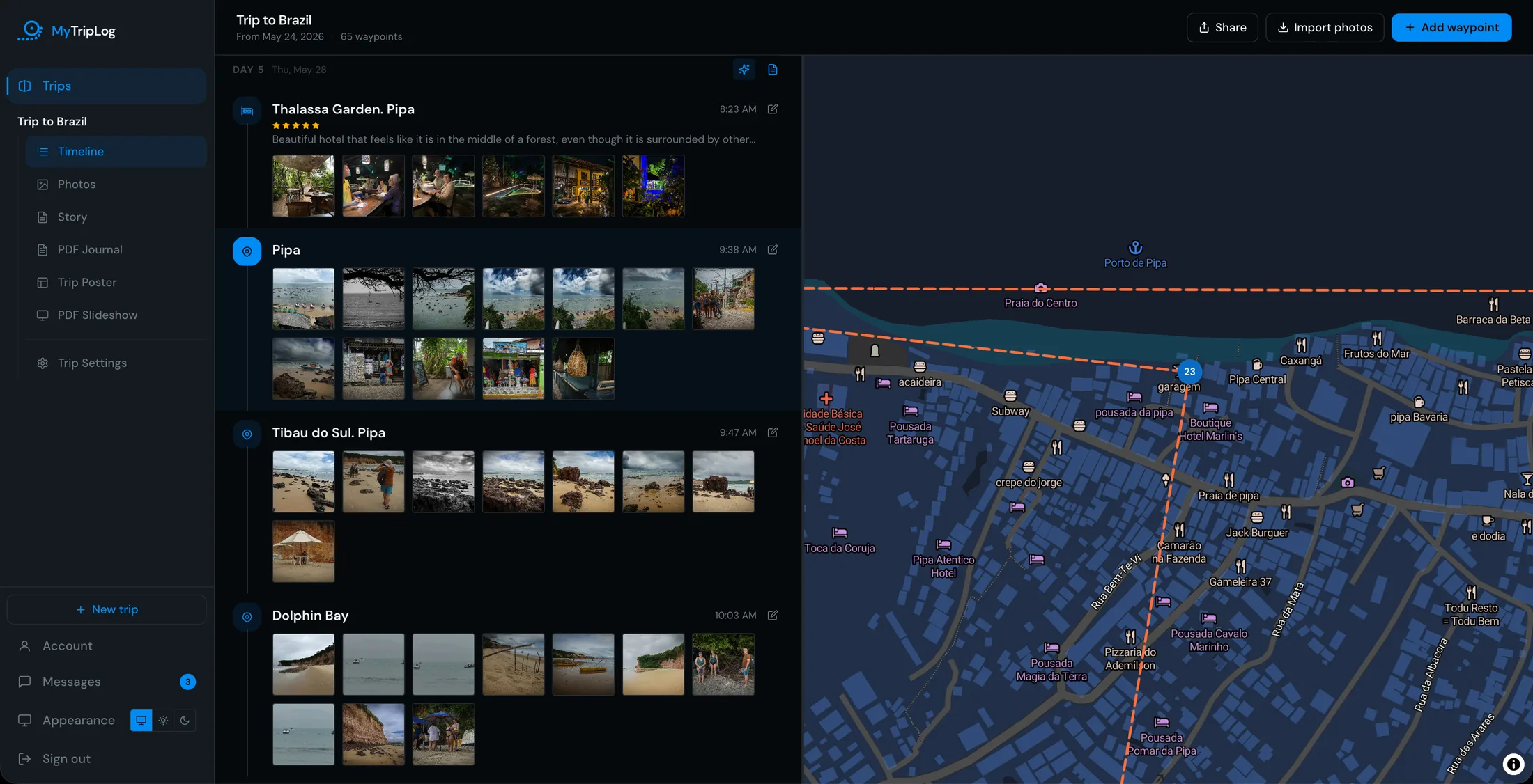
Every place you stop becomes a waypoint, pinned on the map and numbered in the order you got there. Zoom in and each one shows its photo. Select it and you're back in that moment: the time, what you wrote, the pictures you took.
Free · iPhone, phone browser and desktop
Built from the places you log, not a GPS track
MyTripLog doesn't follow you around. It asks for your location only while you're logging a waypoint, so the map shows the places that mattered to you, not every road you drove along.
That also means you can build the map after the fact. Log a place you forgot, set the time, and drop it where it belongs. The route redraws itself in the right order. On iPhone, a photo from your gallery can become a waypoint on its own, placed from the location stored in the photo.
Logging works without signal, too. The waypoint waits on your phone and goes up to the map when you're back online.
The map goes wherever the trip does
The map isn't only for looking back in the app. It travels with everything you make from the trip.
A live link
Send one link and family can follow the map and the timeline as you add to them. They don't need an account.
Postcards and day cards
Every waypoint postcard carries a map of where it was taken. A day story card shows that day's stops on the map, sized for Stories.
A journal and a poster
The trip journal opens each day with its own map. The Route Map poster shows the whole trip as one numbered map, with every stop listed beside it.
Questions
Do I need to track my route with GPS?
No. MyTripLog doesn't record a track or follow you in the background. Each waypoint is a place you chose to log, and the route is drawn between them in the order you were there.
What does the map show?
Every waypoint as a numbered pin, in the order of the trip, joined by the route. Zoom in far enough and each pin shows that waypoint's photo. Select one and the timeline jumps to it.
Can I add a place after the trip?
Yes. Log a waypoint afterwards, set the date and time, and place it on the map yourself. On iPhone you can also make one from a photo in your gallery, using the location stored in the photo.
Can other people see the map?
Only if you share the trip. The share link opens the map, the timeline and the photos, with no account needed, and you can switch it off at any time.
Can I print the map?
Yes. The trip journal has a map for each day, and the Route Map poster shows the whole trip as one numbered map with a list of the stops. Both are laid out in your browser and print from its print dialog.
Want to see one first? There's a sample trip on the home page: thirteen days across Kenya.
Related
Put your next trip on the map.
Create a free account and log your first waypoint in under a minute.